Monday, November 26, 2012

UNIGIS Sub-Saharan Africa PLATO Accreditation


The South African Council for Professional and Technical Surveyors (PLATO) has accredited the UNIGIS professional and MSc courses as complying with their requirements for registration. The Professional and Technical Surveyors Act 40/1984 requires PLATO to accredit academic courses at educational institutions in order for graduates to register in the various PLATO categories.

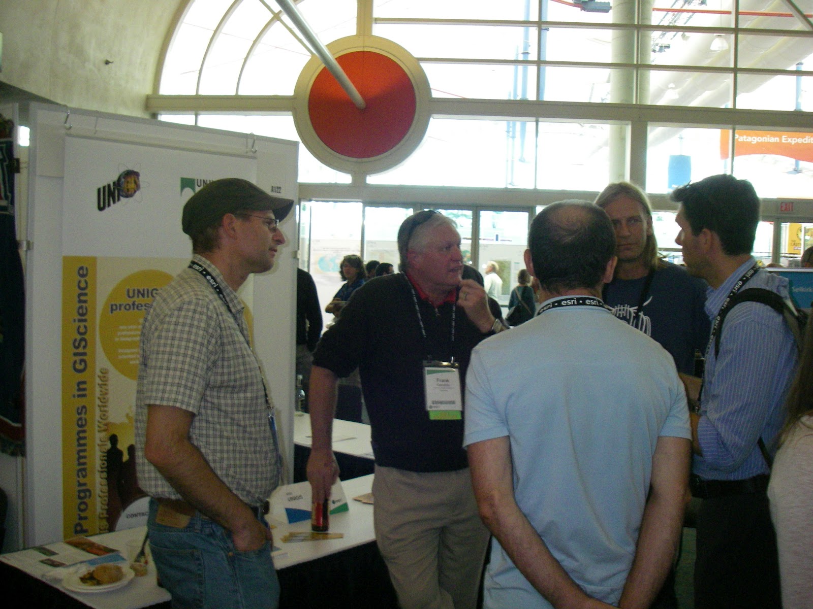
The UNIGIS MSc in GIScience now has been accredited as complying with the requirements for registration as a “Professional GISc Practitioner”, and the UNIGIS professional Diploma is accredited as complying with the requirements for registration as a “GISc Technologist”. This opens up attractive professional pathways and recognized credentials for UNIGIS graduates in Southern Africa.

The MSc and professional qualifications are awarded by the University of Salzburg, and jointly offered through the South African study Centre led by Ann Olivier. The next intake for UNIGIS studies is planned for February 2013.


Monday, October 29, 2012

UNIGIS Academic Excellence Award 2012


During the UNIGIS International annual network meeting, held this year in Salzburg, Austria, the 2012 winner and runners up in the UNIGIS Academic Excellence prize, awarded to the networks top Master's theses, were announced:

First Place, and Winner of the Academic Excellence Award - Samuel KRUEGER (UNIGIS - University of Southern California), for a thesis entitled: Delimiting the postmodern urban center: an analysis of urban amenity clusters in Los Angeles. See USC news release!

Second Place - J P GLUTTING (UNIGIS - Amsterdam), for a thesis entitled: Excess heat-related mortality in micro-urban heat islands: a case-only study in Barcelona.

Third Place - Agnieszka WYPYCH (UNIGIS - Krakow), for a thesis entitled: Spatial modelling of climatic water balance using GIS methods.

The award jury, comprising members from UNIGIS Krakow and Lisbon, and chaired by Richard Armitage from UNIGIS UK, acknowledged the high standards achieved by all the Master’s theses entered for this year’s award from across the UNIGIS International network.  The final decision on the award winner and runners up was based on assessing all entries against criteria comprising: literature review, technical and methodological quality, relevance, presentation and originality.  The final decision between the top three was extremely tight. Congratulations to all the winners!!!

Sunday, October 28, 2012

UNIGIS International network conference in Salzburg

From Oct 24-28, more than 30 representatives from UNIGIS partner universities and study centres worldwide met in Salzburg, Austria for their annual coordination conference. Three full days were dedicated, respectively, to advancing best practice in Geoinformatics distance learning, enhancing cooperation with the geospatial software industry, and to the management and future direction of the UNIGIS network.

With hundreds of graduates each year, and thousands of highly qualified alumni, UNIGIS is making a substantial contribution to the success of a ‘geospatial view’ across many disciplines and industries. The model of a ‘Virtual University of GIScience’, integrating the teaching capacity and competence from a worldwide selection of departments has evolved over more than 20 years from an ambitious initiative into a widely recognized and highly regarded set of international qualifications.

This year a new board of directors for UNIGIS International was elected. Chaired by Josef Strobl from the University of Salzburg, UNIGIS for the next three years will be led by Jasper Dekkers (VU Amsterdam), Gemma Boix (U de Girona), Graham Smith (Manchester MU) and Jacek Kozak (JU Krakow).

Wednesday, October 17, 2012

UNIGIS@ University ICESI, Colombia


In order to deepen the recently established cooperation between UNIGIS in Latin America and the University ICESI, Colombia (http://www.icesi.edu.co), both organizations jointly organized a well-attended GI-symposium at the ICESI campus in Cali. Nearly 200 attendees discussed challenges and opportunities for GIS-practitioners in Colombia with a specific focus on GI-education. On behalf of the UNIGIS team in Latin America we would like to express our sincere thanks to all participants and to the staff of our partner university in Colombia for their participation and collaboration!

Monday, October 15, 2012

The 15th edition of UNIGIS Girona Profesional Master starts!

This 15th UNIGIS Girona edition has more than 40 new students who become part of the worldwide UNIGIS community. Year after year, the number of registration notes the success of our Programme, adapted to the emerging needs and demands more professional environment GIS. 

We train professionals capable of managing, implementing and developing Geographic Information Systems to address and resolve the needs and demands of the professional world. 
UNIGIS Girona team will work hard in order to guarantee the success and recognition of UNIGIS training offer.  

Tuesday, September 18, 2012


Science for Sustainability


UNIGIS alumni (and other) doctoral students might be interested in this International Scientific Conference for PhD Students to be held at the University of West Hungary - Győr, Hungary, March 19-20, 2013

 Talentum Project TÁMOP 4.2.2.B-10/1-2010-0018

See more at : www.nymetalentum.hu/phdconf


As a part of its talent management program, the University of West Hungary is organizing an international PhD conference in order to provide an opportunity for Hungarian and foreign PhD students to exchange views in the presence of distinguished academics and researchers from several disciplines.

Target audience: Hungarian and foreign PhD students.

The scientific hosts of the program are the six Doctoral Schools of the University of West Hungary, which announce symposia in the following disciplines and fields:
  • Environmental Sciences: Bioenvironmental sciences, Geoenvironmental sciences, Environmental pedagogy, Geoinformatics; 
  • Forestry and Wildlife Management: Ecology and diversity of forest ecosystems, Biological basis of forest management, Forest assets management, Forest machinery, Wildlife management, Nature conservation; 
  • Crop Production and Horticulture: Microorganisms in the crop-soil system, Precision agriculture: production-oriented integration of crop protection and crop treatment methods, Development of crop production technologies; 
  • Animal Husbandry: Animal breeding and management, Animal nutrition, Animal product processing and quality assurance, Energy-efficient and quality-preserving dehydration, storage and processing of biological materials, Economic aspects of animal agriculture; 
  • Wood Sciences and Technologies: Wood science, Wood processing technologies, Wood structures, Pulp and fiber technology, Informatics and management in the wood industry; 
  • Business and Management: Public economics, Marketing, International economics, Business economics and management, Social and economic contexts of human resources. 
Form of presentations: oral or poster. Attendance of the professional program at the conference is free of charge. Language(s): English is the official language of the conference. Simultaneous English/Hungarian interpretation will be provided for the plenary session. Official language of the sections: English.

Alumni network has grown to 1500!


Alexander Willberg has finished the German-language UNIGIS MSc study programme at the University of Salzburg with an excellent Master Thesis on hyperspectral remote sensing for land use change detection. With his graduation Mr Willberg not only achieves a major milestone in his personal career but also rounds off the UNIGIS Salzburg alumni network as the 1500th graduate - MSc and diploma/certificate programmes combined.

Congratulations!

Friday, September 7, 2012

LiDAR Intensive Programme

Event announcement - LiDAR Intensive Programme


This short intensive programme on the state of the art in LiDAR science, methods and technologies is organized and hosted by the University of Salzburg, Department of Geoinformatics – Z_GIS with the support of the innovative European LiDAR Mapping Forum (www.lidarmap.org/ELMF). The course is designed around and closely integrated with the leading European LiDAR event, bringing top visionaries, key developers and technology representatives into an intensive, small group learning environment.
We invite graduate students, young researchers and junior staff with a focus on research, development and applications involving LiDAR technologies and methods. Sponsors from the LiDAR and wider geospatial communities have pledged a number of scholarships for top candidates interested in the course. Participants have full access to the ELMF (Dec. 4/5, 2012, Salzburg, Austria).
For registration and further details please visit our website at www.zgis.at/IntensiveProgrammes or contact us at lidar2012@edu-zgis.net.
Online registration starts on September 5, 2012. Applications are accepted until October 15, 2012 (scholarship applicants). Final application deadline: November 15, 2012.

Sunday, August 26, 2012

Professor Josef Strobl has been awarded an honorary doctorate (doctor honoris causa) by the University West Hungary, Faculty of Geoinformatics for his significant contributions to education, research and networking on geoinformation science and technology. His contribution has substantially improved e-learning solutions in this field and its applications.
 The award ceremony will take place on 14 Sep 2012 in Szekesfehervar in the opening session of the 50th Anniversary of the Faculty. Szekesfehervar the town of Kings, where the Hungarian kings were crowned in the middle ages. The city hosts the school of surveying and land management from 1972. The first department of geoinformatics was founded here in 1994.

Sunday, August 5, 2012

Nepal mapped on UNIGIS International network!

Nepal secured its location on the map of the UNIGIS International network  last week after UNIGIS@Kathmandu welcomed its first batch of 10 students. An orientation workshop was jointly conducted by Dr. Shahnawaz (Director S/E Asia, UNIGIS International) and Dr. Krishna Poudel (Coordinator, UNIGIS@Kathmandu) from 1st to 4th August, 2012 at the host institution Kathmandu Forestry College (KAFCOL).

The opening session of the orientation workshop was attended by about 30 participants including current and potential UNIGIS students, top administration of KAFCOL and several senior officials from various national and international agencies in Nepal. The Principal of  KAFCOL, Dr. Bishnu Hari Pandit, welcomed the participants and expressed immense pleasure that his college has become a study centre of a unique international network active in offering high quality GIScience education worldwide. Some senior officials conveyed that they have great expectations from UNIGIS MSc graduates in terms of  increasing the highly skilled GI-workforce in Nepal, because this is the first Master level GIScience study programme in the country.

UNIGIS@Kathmandu plans to expand academic and professional links with academia and industry in Nepal as well as organise awareness / introductory workshops in different parts of the country. UNIGIS@Kathmandu will seek close collaboration with the Nepal GIS Society for promoting common objectives.

Sunday, July 29, 2012

News from UNIGIS in Latin America


Over the last two months, UNIGIS put considerable effort in expanding its activities in Colombia. Our team from the study center in Cali exhibited at the technology fair ’Geomatica Andina 2012’ which took place between June, 4th and 5th in Bogotá, D.C. presenting the program to an interested audience of GIS-practitioners in Colombia. 
On July, 11st Richard Resl, director of UNIGIS in Latin America and Francisco Piedrahita, rector of one of the most prestigious Colombian universities, ICESI in Cali, signed an agreement of cooperation. From now on ICESI will act as official academic partner of UNIGIS in Colombia, giving UNIGIS activities in Colombia a strong and sustainable institutional background. In return, the Colombian UNIGIS team will train academic staff of ICESI in basic GIS-skill. We are looking forward to a successful cooperation!

Tuesday, July 24, 2012

UNIGIS at the ESRI User Conference

The UNIGIS International Asscociation is at the annual ESRI User Conference. This year more than 15,000 GI professionals from around the world turn San Diego to a global GIS hotspot. An excellent opportunity not just to learn about new features of ArcGIS software and ESRI's 'road ahead' but also to build upon and expand UNIGIS' wide name recognition, to meet prospective students and to network with a wide range of GI-related interest groups and organisations.

Thursday, July 5, 2012

Best UNIGIS Salzburg Master Thesis

Claudia Schenk received the UNIGIS Master Thesis Award 2012 for the best thesis at UNIGIS Salzburg. In her MSc research she modelled the historic city of Potsdam in a 3D visualisation for exploration and analysis. To learn more about this award-winning work download the thesis from the UNIGIS Alumni website.
Awarding ceremony at the GI_Forum Buffet Dinner

Congratulations, Claudia Schenk!

Two award-winning UNIGIS graduates present at GI_Forum


Stephanie Brand (UNIGIS Salzburg) and Peter Witt (UNIGIS Manchester) presented their Master Theses at the GI_Forum conference in Salzburg. For their outstanding work the two graduates received the UNIGIS International Academic Excellence Prize 2011 from the UIA-Chair Prof Josef Strobl. Congratulations!
Stephanie Brand "Roof surface classification with hyperspectral and laser scanning data. An assessment of Spectral Angle Mapper and Support Vector Machines"

Peter Witt "The development of a predictive hiking travel time model accounting for terrain variations"

Monday, July 2, 2012

Roland Graf wins AGEO Thesis Award

Congratulations to UNIGIS MSc student Roland Graf for winning the 2nd place in the Master Thesis Competition of the Austrian Umbrella Organisation for Geographic Information (AGEO)!
Roland Graf combined in his excellent thesis the support vector machines (SVM) image classification method with the segmentation approach of object based images analysis (OBIA). This conceptual approach was successfully implemented and tested with help of the eCognition software.
The awarding ceremony of the AGEO prize will take place at the AGIT / GI_Forum conference, 4. July 2012 at the University of Salzburg, where Mr. Graf will also present the outcomes of his research.

Thursday, June 21, 2012

UNIGIS @GEOSummit Bern

Today the biggest conference on geoinformatics in Switzerland came to a successful end. UNIGIS was part of the first time "GEOSummit" which is the successor of the formerly GIS/SIT. The bianual conference and exhibition aims to bring together users, business partner and to a certain degree scientists.
For UNIGIS it was definitely the right place to be as there is a growing community of UNIGIS students, alumnis and potentially new students in Switzerland. Together with our Swiss cooperation partner (HSR Rapperswil) we enjoyed the very high frequence at our booth and the friendly and communicative atmosphere.
Once again it became obvious how cooperations in the field of GIS education lead to a significant benefit as they enlarge networks, open new doors and combine existing competences.
With the strong feeling that there is still a quite high demand for a flexible, distance based offer for GIS education UNIGIS is getting ready for the next big event: this year's AGIT & GI-Forum in Salzburg. See you there!

Wednesday, June 13, 2012

UNIGIS Academic Excellence Prize 2012

The UNIGIS International Association is pleased to announce this year's 'UNIGIS International Academic Excellence Prize' competition. The UNIGIS Academic Excellence Prize, launched in 2007/08, is awarded on an annual basis to a student, from one of the UNIGIS Centers Worldwide, who submitted the most outstanding MSc Dissertation/Thesis, or paper based on a thesis, during the previous academic year.
The criteria used by the evaluation committee include: technical quality, quality of literature review, relevance, presentation and originality. The standard of work submitted last year was excellent, and similarly high standards are expected this time.
The competition for the 2012 Prize is now open! Candidates must submit their MSc thesis or paper through their graduating UNIGIS partner institution no later than August 31.

Monday, June 4, 2012

UNIGIS Salzburg – Communication matters

“Especially in distance study programs like UNIGIS a key factor of personal success is getting to know fellow students in the beginning and to develop a culture of discussion and mutual support in learning processes” explained Prof. Josef Strobl, Director of UNIGIS Salzburg and Chair of UNIGIS International to a group of 14 new UNIGIS professional students participating in an introductory workshop last weekend in Salzburg. At latest by the dinner in a traditional pub in the city center the ice was broken. No matter if this was a result of the mentioned advice or just a natural consequence of having a group of nice people around a table in a snug atmosphere – the workshop provided a good starting point into a year of learning together.

Friday, May 18, 2012

UNIGIS now an Academic Member of FIG

The 35. FIG (International Federation of Surveyors) Working Week was held in Rome from the 6th to the 10th of May in 2012. The motto of Italian Working Week is "Knowing to manage the territory, protect the environment, evaluate the cultural heritage". 500+ papers have been accepted for presentation in Rome in almost 100 sessions, forums and workshops (http://www.fig.net/fig2012/downloads/tech_prog.pdf). Many of the papers are peer reviewed and published soon at the Surveyors Reference Library (http://www.fig.net/srl/). 

The FIG Council has admitted UNIGIS International Association as an academic member of FIG. The Certificate of Academic Membership was presented by FIG President, CheeHai TEO to Prof Bela MARKUS in a ceremony during the General Assembly.

Sunday, May 13, 2012

Next UNIGIS course for Central Asia students

The UNIGIS study centre for Central Asia at ACA*GIScience in Bishkek has now opened the registration period for the next intake of distance learning students, starting with October 2012. Applications will be accepted until September 10, and candidates are expected to have a background in any 'spatial discipline' or experience in a GIS application domain.

UNIGIS Central Asia offers tutoring in Russian language, but as an international program requires profound English language skills for working with study materials, complete assignments and communicate within the worldwide network of UNIGIS students and alumni.

With a clear focus on continuing education for geospatial / GIS professionals, most candidates come from national and international organisations, the geospatial services industry, and academia. For the first time, candidates are offered the options of registering for a professional diploma or an MSc program of studies, with both qualifications awarded by the University of Salzburg, Austria.

Further information can be found at http://bishkek.unigis.net, email enquiries can be directed to office.bishkek@unigis.net

Friday, May 11, 2012

New students in Ecuador and Colombia

By the end of April, the UNIGIS site in Quito welcomed 70 new students from Ecuador, Colombia and other Latin American countries as new members of the UNIGIS community of learning. They will join of group of 250 active students that already are enrolled at the University San Francisco de Quito in Ecuador. Being part of an academic program that is tailored to the specific needs of GIS professionals in the emerging GIS-market between Patagonia and the Rio Grande opens up great opportunities for professional and personal development.

Welcome – Bienvenidos!

Wednesday, May 9, 2012

UNIGIS programmes launched in Nepal!

UNIGIS@Kathmandu (NEPAL) takes pride in announcing the first open admissions period for the UNIGIS professional diploma and UNIGIS MSc in Geographical Information Science and Systems. The two UNIGIS study programmes are being offered in Nepal by the Kathmandu Forestry College in collaboration with the Centre for Geoinformatics (Z_GIS), University of Salzburg, Austria. The academic certification / degree will be awarded by the University of Salzburg, Austria. The Ministry of Education, Govt. of Nepal has already confirmed their endorsement of UNIGIS qualifications.

This academic collaboration between Nepalese and Austrian institutions aims at providing internationally standardised high quality Geoinformatics and GIScience education to young students and active professionals within Nepal, who aspire to make a career in this vibrant field or want to enhance their capability to meet the challenges and demands of the rapidly growing international job market.

For further details: see www.unigis.net/kathmandu OR send e-mail to office.kafcol.kathmandu@unigis.net

Monday, April 16, 2012

UNIGIS Team Salzburg - Work Retreat

The UNIGIS Team Salzburg held a work retreat on April 12.-13., 2012, to discuss in depth the strategic development of two UNIGIS cornerstones:

An entire day was dedicated to reflect on the current status of UNIGIS modules and future paths to take. A particular focus was given to the alignment of content and materials between the two languages (German and English) and where adequate also between the two UNIGIS programmes (UNIGIS professional / UNIGIS MSc). To provide guidance on content development in terms of syllabi and adequate learning materials and -media several team members take a role as ‘theme lead’ for a particular subject.

The agenda for the second part of the meeting was reserved for discussing alumni-networking activities.

It was a successful and inspiring meeting in the mountainous surroundings of Salzburg. On the way home, our bagpacks were filled with fresh ideas and motivation to …educating GI-professionals worldwide.

Monday, April 9, 2012

UNIGIS participated in ASEMUNDUS Seminar!

The ASEMUNDUS Networking Seminar co-financed by the European Commission under Erasmus-Mundus programme was orgnised in Bangkok, Thailand on 2nd and 3rd April, 2012.

Dr. Shahnawaz (Director S/SE Asia, UNIGIS International) was invited to the seminar and he informed the participants about UNIGIS network in general and UNIGIS initiatives in the region in specific. The seminar participants were highly impressed with the UNIGIS philosophy of 'Educating GI-professionals Worldwide' and several institutions enquired about the possibilities of becomming a part of this excellent network offering GIScience education through online distance learning programmes.

Friday, March 23, 2012

GISopen conference in Szekesfehervar: a qualitative contribution from UNIGIS graduates.

The GISopen conference was initiated in 1997, just after the first UNIGIS intake was graduated from the University of West Hungary, Faculty of Geoinformatics. The annual GISopen conference is the longest GI related conference series in Hungary. The main aim is to involve the faculty alumni into the active lifelong learning process, to give a forum for the ex-students and to offer them an opportunity to share their experience after several years of professional activity.

From 12 to 14 of March 2012, the 16th GIS open conference was organised in Szekesfehervar. The number of participants was 200+ like in the previous years.

The motto of the conference was “answering the basic questions”

In our profession, in the recent years, a major paradigm shift was the transition from editing of maps to the development of databases. By the analysis of the databases we can provide answers to the basic questions of GIS, serve our users with value-added products and information services. The presenters were asked to speak not only about the technical aspects, but more on the economical and strategic background.
• What is this? Associated with metadata services appear geodata services. But how much does it cost? The systems often look for complex solution to a simple question. What are the issues to be related to practical solutions?
• Where is it? Many people at the land administration are working on the repartition of undivided common land property. Where are the parcel boundaries, and how do we perform it?
• Where to go? Everybody is using navigation systems. But where are we going? The new surveying law will define our tasks for years.
• What has changed? In the world, the only constant is the change itself. Let’s look in concrete! What is the building monitoring?

All the conference participants (keynote speakers, presenters of research papers, GI industry software and hardware companies) tried to answer these questions. All the attendants realized that in spite of the simplicity of the questions, the answers required much more than technical concepts and could only be answered with indirect and quite complex considerations.

8 papers were delivered by UNIGIS graduates out of the 47 presentations.

Among the keynote papers, László Gombás delivered a presentation about smart building-surveying technologies. Leica is starting a new family of custom-built solutions for building and site construction, called iCON. More than a new product line and a software package, it enables construction companies to enhance their performance, and increase their profitability through perfecting their construction workflow.

Hardware and software companies could promote their products in a forum and do presentations as well. GeoCalc GIS 2.0 software was introduced by Attila Kulcsar. He presented the main functionalities of this GIS developed on open source software.

On the afternoon of the second day a UNIGIS session was held with the following presentations:
• Quality management in iGO (http://www.nng.com/hu) navigation database development (Lukács Lilla)
• In-door data acquisition technologies (László Gombás)
• GIS use in climate modelling (Norbert Móricz)
• Run-off control for soil protection (Margit Horoszné Gulyás)
• Underground water flow monitoring as a base of remediation (Béla Finta)


Wednesday morning Tibor Márfai delivered a presentation about informatics of digital maps by introducing basic definitions.
Next year the focus will be on future cadastres. How to include the 3rd dimension into the current land administration system? How to move from static databases to dynamic cadastral modelling? How social networks will transform the cadastre? How cadastre will be part of the geospatial infrastructure and serve the society? etc.

Gregory Lucas and Bela Markus

Wednesday, March 14, 2012

UNIGIS graduate winning top award at RTM!


Each year, the „Runder Tisch GIS“ at the Technical University of Munich awards prices for top theses in Geoinformatics.  Outstanding Bachelor and Master Theses as well as PhD Dissertations compete for this distinction, with winners being announced and their work presented within the framework of the annual “Münchner Fortbildungsseminar Geoinformationssysteme”:

Today, UNIGIS Salzburg alumn Matthias Boedecker received the 1st prize for his excellent Master Thesis “Koordinierung thematischer Klassen unter Verwendung kartographischer Relationen” (see summary). Congratulations, Matthias, for this success, combined with best wishes for your professional future!


Sunday, March 11, 2012

UNIGIS in Malaysia!

Facilitating an ongoing process of integrating institutions from Southeast Asia into the international UNIGIS network of universities, UNIGIS representatives again participated in this year's Malaysia Geospatial Forum organised at Melaka, Malaysia on 6th and 7th March, 2012.

Dr. Shahnawaz (Director, UNIGIS S/E Asia) managed an exhibit booth shared with Geomatika College International, as well as organised a series of workshops for students, teaching faculty as well as professionals engaged at various institutions and organisations.

Tuesday, March 6, 2012

Open Web Services & Web Mapping Applications Summer School Girona


From 9th to 13th of July 2012 will take place the 3rd Summer School dedicated to Opensource GIS in Girona, organized by SIGTE of the University of Girona, and the collaboration of OpenGeo and the Geospatial Institute of the University of Nottingham.


From the start, the aim of this initiative to meet the GIS professional demands related to free and open solutions. The Summer School 2012 will be focused on the development and creation of Open Web Mapping Services and Web Applications.

If you are interested in application development and creation of web map services using the most widely used free market products such as PostGIS, GeoServer, OpenLayers, then this is the opportunity.

Participants will complete the Summer School with a certificate of attendance showing the course hours. Considering the workload, the Summer School can be accredited by their home institutions with 2 ECTS credit points.

And beyond the strict quality and technical level of the programme, there is the charm of the historic city of Girona and the magnificent Old Town and its wide range of cultural, musical and culinary offer; and the hospitality that has always distinguished the organization team, recognized in each of the initiatives that we undertake.


More information


Sunday, February 26, 2012

Top academic credentials for UNIGIS Hungary alumnus


Ervin Pirkhoffer PhD (UNIGIS alumnus, 2004-2006) held his habilitation (’second doctorate’) lectures at the Faculty of Sciences, University of Pécs on February 16. The titles of the lectures were ”GIS Approaches in Modelling” (lecture for students) and ”Flash Flood Modelling” (scientific presentation in Hungarian and in English).

After acceptance of his professorial thesis, Ervin Pirkhoffer presented a scientific lecture on general features of flash floods and the impact of climate change on flash flood frequencies and magnitudes. Among the broad range of modelling approaches, he emphasized the findings of his research group. He outlined the strenghts of GIS applications in modelling and prediction from several viewpoints and presented risk maps produced by the research group using a ’rapid screening’ approach in ArcGIS environment. The monitoring system operated by the research group represents the basis for the development of a real-time forecast and warning system.

The cumulative rating for three lectures was 95 per cent, and the Defense Committee proposed granting of the title of habilitated doctor to the Doctoral and Habilitation Committee of the University of Pécs.

Dr Pirkhoffer is already the 2nd graduate from the UNIGIS Hungary programme continuing to achieve this highest academic qualification – Congratulations!

Tuesday, February 21, 2012

New edition of UNIGIS studies started at Jagiellonian University, Poland.


Last weekend students of intake 2012 arrived to Kraków to take part in their first two-day UNIGIS workshop.

First day was dominated by rather non-GI issues like studies program and organization as well as e-learning educational and technical aspects. In the afternoon students were encouraged to build “learning alliances” by getting know each other during students’ self-presentation and common dinner in one of restaurants in the Kraków Old Town.

Second day was devoted mainly to GIS software used during the studies, which was presented and tested by students in the computer laboratories of Institute of Geography and Spatial Management.

We hope that students came back home with strong motivation and good social support to start successfully their studies. Good luck!

Friday, February 17, 2012

Once again: UNIGIS professional attracts practitioners from near and far.

After a very successful last year in terms of student registrations for the UNIGIS professional certificate in Salzburg, the popularity of this application-oriented GIS study program offered by the Centre of Geoinformatics is continuing in 2012.

Most of this year's first group of students attended the introductory workshop a few days ago to 'dive into' an innovative and partly unfamiliar learning environment, and getting to know fellow students and UNIGIS faculty.

The broad range of participants' background domains  indicate the integrative character of spatial information science. Beyond that, a stimulating atmosphere for collaborative learning not only for students, but for the entireUNIGIS community is created by this variety.

Besides this range of domain-specific experience, the geographical distribution of students is remarkable. With participants coming from the very North of Germany as well as from South Tyrol, the Vienna region and Switzerland, the value of a study program exclusively taught online is being successfully demonstrated.


P.S.: The next UNIGIS professional study group starts in May 2012.

Saturday, February 11, 2012

Directions of Geospatial Technology - India Geospatial Forum

At this year's India Geospatial Forum in Gurgaon, Feb 7-9 Prof Josef Strobl from UNIGIS International was invited to the Plenary Panel on 'Dimensions and Directions of Geospatial Technologies'. In a session joined by Dr. V K Dadhwal (Director NRSC India); Rajesh Mathur (Vice Chair ESRI India) and J. B. Monnier (Senior VP Bentley Asia), Prof Strobl was presenting 'Live Geography' as one of the key trends in today's geospatial developments.

India's leading Geoinformatics event did not only again succeed in bringing together top decision makers, scientists and business representatives, but presented a rich industry exhibit and served as a reference platform for academic research and higher education. UNIGIS India director Dr. Shahnawaz welcomed numerous UNIGIS alumni from across the subcontinent, and consulted with current and prospective future students.


Friday, February 3, 2012

UNIGIS MSc: 2012 class is taking aim ...

... at reaching their objectives! After having started their studies earlier this year, more than 50 new MSc candidates are convening at the University of Salzburg for their getting-acquainted workshop. A mixed agenda of introductions, orientation sessions on curriculum / modules / learning platform / approaches to study, plus reflecting on motivations and objectives for their studies keeps everybody involved.

The main objective of the workshop of getting everyone off 'to a good start' into their UNIGIS MSc studies requires a clear focus on establishing communications and building a 'community of learning practice'. This year's group again has a diverse background from surveying, geography, computing, natural resources, planning, engineering and more - clearly demonstrating the transversal methodology focus of Geoinformatics.

UNIGIS degrees and certificates have an excellent record as key building blocks for 'geospatial' careers in industry, public service, NGOs and academia. The Salzburg UNIGIS team wishes all new students a successful start into this intensive phase of their lives, and reaching of all personal and professional objectives!

Thursday, January 19, 2012

UNIGIS joining FIG as Academic Member

UNIGIS is proud to announce that at the latest Council Meeting of the International Federation of Surveyors (FIG), the Council decided to welcome UNIGIS as an Academic Member.

FIG was founded in Paris in 1878 and is the premier international organization representing the interests of surveyors worldwide. It is a federation of the national member associations and covers the whole range of professional fields within the global surveying community. It provides an international forum for discussion and development aiming to promote professional practice and standards.

Academic membership links universities or their faculties or departments, that are responsible for surveying education and related disciplines in more than 110 countries. These institutions promote education or research in one or more of the disciplines of surveying.

UNIGIS is honoured to share these objectives with FIG, and we are looking forward to fruitful cooperation in the future!