Thursday, October 31, 2013

UNIGIS @ GISSA AGM & Conference


UNIGIS Sub-Saharan Africa was one of the sponsors for this year’s GISSA AGM & Conference. GISSA represents the Geo-Information community in South Africa as a national, unified, representative body to promote and protect the interests of its members. 

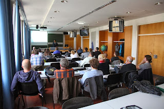
A student event was held with quite a number of the Eastern Cape Students."It is nice to finally meet our lecturer", said Khanya Ntleki from Buffalo City Metropolitan Municipality. Thozama Dyonase mentioned the presence of UNIGIS at the GISSA conference helped us foresee what’s ahead in the course and what to look out for in the future.

Saturday, October 26, 2013

UNIGIS Academic Excellence Award 2013

During the UNIGIS International annual network meeting, held this year in Krakow - Poland, the 2013 winner and runners-up in the UNIGIS Academic Excellence Award, dedicated to the network's top Master's theses, were announced:

First place;
- and Winner of the Academic Excellence Award - Victoria Ann CLIFF (UNIGIS - Sub Saharan Africa), for her thesis entitled: "The integration of GPS and GIS technologies as a methodology to monitor beach-dune systems: Port Elizabeth, South Africa".

Shared second place;
- Maja RAPP (UNIGIS - Salzburg), for the thesis: "Biomass-mapping of alpine grassland with APEX imaging spectrometry data".
- Jeroen Gerhard STEENBEEK (UNIGIS - Manchester/Amsterdam), thesis title: "Bridging the gap between ecosystem modelling tools using Geographic Information Systems".

The award jury, comprising members from UNIGIS UK and Lisbon, and chaired by Jacek Kozak from UNIGIS Krakow, acknowledged the high standards achieved by all the Master’s theses entered for this year’s award from across the UNIGIS International network.  The final decision on the award winner and runners-up was based on assessing all entries against criteria comprising: literature review, technical and methodological quality, relevance, presentation and originality.  The final decision between the top three was extremely tight. Congratulations to all the winners!!!

Friday, October 25, 2013

Annual UNIGIS network meeting @Krakow

This weekend, UNIGIS Krakow is hosting the annual worldwide network meeting at the Jagiellonian University, Krakow. As one of the oldest European universities, 'UJ' was one of the first to adopt the innovative distance learning approach for geospatial professionals, and already is serving as a venue for this gathering for the second time.

Program directors and course coordinators from 10 partner institutions are working through a dense agenda including curriculum coordination, development of study modules, linkage with technology providers, novel elearning technologies, alumni relations and outreach concepts. The value added from integrating the competences and capacities across a global network of dedicated educators clearly demonstrates the uniqueness of UNIGIS.

Suchith Anand from the ICA Commission on Open Source Geospatial Technologies was discussing the potential for closer cooperation with UNIGIS partners within the framework of the "Geo for All" initiative, including the role of ICA-OSGeo labs in making students familiar with OS technologies.

UNIGIS is a worldwide network of universities cooperating since the early 1990ies in the design and delivery of distance learning in Geographical Information Systems and Science. The UNIGIS network offers Postgraduate Certificate, Diploma and Masters courses, aiming at 'Educating GIS Professionals Worldwide'.


Monday, October 21, 2013

Starting in Salzburg, 18 (future) GI-professionals will make their way!


Last weekend was a perfect start. A start not just into a year of demanding coursework, but also a start to advance careers by acquiring a comprehensive set of skills and competences in applied Geoinformatics.  After finishing their UNIGIS professional studies, our new group of 18 committed people with backgrounds in Archeology, Botany, Geography, Geology, Ecology, Forestry, Landscape Architecture and Surveying will be able to make out more of their spatial data. 

They all  will know how to use of GIS and related technologies to acquire, model, distribute and analyze geolocated data, how to derive meaningful information from it and how to communicate this information to others by means of clear and easy to understand maps and visualizations. Since spatial is special, having competence in “spatial” is special in the job market as well. A look into the careers of numerous UNIGIS alumni provides proof enough. We from the UNIGIS Salzburg team will try our best to support our new students along their individual learning paths and wish a successful year of study!

Thursday, October 17, 2013

UNIGIS Girona starts the 16th edition!

 
This new academic year UNIGIS Girona starts its 16th edition and more than 40 new students have enrolled the UNIGIS Programme. They are already part of the worldwide UNIGIS community. 


The number of registrations remains edition after edition and this is a proof of UNIGIS Programme's succes. We train professionals capable of managing, implementing and developing Geographic Information Systems to address and resolve the needs and demands of the professional world.
UNIGIS Girona team will continue working hard in order to guarantee the success and recognition of UNIGIS training offer.  

Monday, September 30, 2013

UNIGIS Master Thesis workshop in Salzburg

More than 20 students (UNIGIS MSc 2012) presented a current status of their Master Thesis. The workshop was held from 27th to 28th of September in Salzburg. High quality presentations from various sectors of GI and a lively discussion among students and the teaching team led to an informative and entertaining meeting. All the best for the final steps!

Friday, September 27, 2013

UNIGIS Sub Saharan Africa October 2013 - new Intake


UNIGIS Sub Saharan Africa would like to welcome the new intake beginning in October 2013. 30 students are going to start with their UNIGIS Professional and MSc studies in Geographical Information Science and Systems.   
Byron Usswald, Innocentia Gumede and Odwa Mendile

Byron Usswald stated “I chose UNIGIS as it is the leader in GIS education as far as I'm concerned. I didn't want to merely become qualified, I wanted to distinguish myself from the pack.” Innocentia Gumede said she was very excited to get started. Odwa Mendile stated: "UNIGIS will transform me into a spatially skilled young professional. I shall do wonderfs for my local municipality where I work as a GIS Technician." 

We wish all these students all the best in their studies!

Your UNIGIS Sub Saharan Africa Team


Thursday, September 26, 2013

UNIGIS: Geospatial Capacity Building at AGF'13 in Kuala Lumpur


UNIGIS was invited to contribute to the Asia Geospatial Forum 2013 held in Kuala Lumpur, Malaysia from 24th to 26th September, 2013 and conduct a 'Geospatial Capacity Building and Student Forum' for bringing together academia, industry, organisations and students at a common platform for face-to-face interaction. The AGF is one of the biggest regional GIS conferences in S/E Asia and has been organised in a different country every year since 2003. UNIGIS has been entrusted with a prominent role at the event since 2005.

Dr. Shahnawaz (Director, UNIGIS S/E Asia) represented UNIGIS and gave the lead presentation setting-up the overall framework as well as moderated the forum involving about 40 participants. The opening session was devoted to a panel discussion including distinguished experts from Cambodia, Indonesia, Malaysia and the Philippines. They exchanged their experiences and visionary ideas about Geospatial education in the ASEAN region. This was followed by a session dedicated to students  presenting their ongoing Master / Ph.D. level research.

The forum concluded with a vibrant open-floor discussion where a majority of students expressed that the courses related to Geospatial education offered by several educational institution in the region are not up to the mark. On the other side, teachers expressed their frustration about a lack of support for updating the standards of their GIS laboratories.

It was widely recognised that there is a need of forming a network for knowledge and resource sharing and, perhaps, UNIGIS is an appropriate leader in this direction!

Monday, September 2, 2013

2013 UNIGIS class starting at Madras, India

The 3rd intake of MSc and professional certificate students at UNIGIS@Madras University, India started its UNIGIS studies from 2nd September, 2013. Dr. Shahnawaz (Director UNIGIS S/E Asia) and Dr. R. Jaganathan (Coordinator UNIGIS@Madras) conducted a 2 days online orientation workshop with the 11 new students on 31st August and 1st September. These candidates were introduced to the UNIGIS mode of online distance education in Geographical Information Science and Systems as well as given a detailed orientation about learning management, assessment and available resources.

All these students are excited to embark upon a unique experience of achieving their international academic qualification by studying and completing an international online distance learning programme.

Friday, August 23, 2013

UNIGIS at HealthGIS 2013 in Bangkok!


UNIGIS was invited to contribute to a GIScience capacity building workshop at the 5th International  Conference on HealthGIS held in Bangkok, Thailand from 21st to 23rd August, 2013. Dr Shahnawaz (Director UNIGIS S/E Asia) conducted the workshop entitled 'GIScience Education and Training - the Need for Health Professionals' which was attended by more than 30 participants having their disciplinary background in a range of subjects, however a large majority came from various areas of health related fields either by education or by professional engagements.

An extended discussion focussed on the issue that conventionally health professionals are not taught / trained to use geospatial data, technologies and tools. These are becoming increasingly important for understanding the dynamics of several illnesses and diseases. They also expressed that they have rarely come across a GIScience education / training programme designed to fulfíll the needs of the health professionals.

The overall conclusion of the workshop was that there is a pressing need of developing and introducing short duration GIScience education / training programmes specifically designed for health professionals. A nearly unanimous proposal from the audience suggested that an international organisation like UNIGIS should take initiative in this direction, because it has well established experience of designing, developing and offering innovative online distance learning programmes in GIScience and -Systems.

Monday, August 19, 2013

UNIGIS Week in Kathmandu, Nepal!

UNIGIS@Kathmandu celebrated the 1st year of its inception at Kathmandu Forestry College (KAFCOL) during the week of 12th to 16th August, 2013. The event was inaugurated with a meeting of the Board of Studies attended by Dr. Ramji P. Neupane (KAFCOL President), Dr. Bishnu H. Pandit (KAFCOL Principal), Dr. Krishna P. Poudel (UNIGIS Coordinator) and Dr. Shahnawaz (Director, UNIGIS S/E Asia). The board reviewed the progress of UNIGIS during the last year and appraised the overall strategy for further expansion during the next years.

 Dr. Shahnawaz and Dr. Krishna P. Poudel conducted 2 intensive workshops, including an orientation workshop for 12 new students of the 2nd intake as well as a Project Management and Master Thesis workshop for 2nd year students of the UNIGIS MSc programme.


The event concluded with a meeting of the Instructors of UNIGIS@Kathmandu leading to a vibrant discussion session with the current and incoming UNIGIS students.

Saturday, July 20, 2013

Int'l Journal of Geoinformatics: Special UNIGIS Issue

The UNIGIS special issue in the International Journal of Geoinformatics now has been published. In this journal edition, UNIGIS graduates and teachers from a mix of UNIGIS partner institutions worldwide have contributed current research articles - demonstrating the link between creating new knowledge through research, and conveying current knowledge through education.

As the content is available via open access, you are encouraged to register and peruse this issue online via the following URL (registration is required): http://journals.sfu.ca/ijg/index.php/journal

Special thanks for making this publication possible are due to Dr Shahnawaz as issue editor, and to Dr Nitin Kumar Tripathi as the editor-in-chief!

See below for Table of Contents :
Vol 9, No 2, (2013)

  • UNIGIS Online Distance Learning Towards International GIScience Qualifications - Shahnawaz S.
  • Accuracy of SRTM-X and ASTER Elevation Data and its Influence on Topographical and Hydrological Modeling: Case Study of the Pieniny Mts. in Poland - Czubski K. 
  • Modelling the Spatial Invasive Range of Heracleum mantegazzianum in Europe - Wallentin G 
  • Social Media Location Intelligence: The Next Privacy Battle - An ArcGIS add-in and Analysis of Geospatial Data Collected from Twitter.com - Weidemann C. 
  • The Effect of ACRC on the Results of Cartographic Classification Depending on Spatial Autocorrelation - Loidl M. 
  • Land-cover change in Goa– An Integrated RS – GIS Approach - Kotha M. 
  • Multi-Criteria GIS Analysis and Geo-Visualisation of the Overlap of Oil Impacts and Ecosystem Services in the Western Amazon - Zurita Arthos L. 
  • Slum Modelling by using Ontology and Geoinformatics: Case study of Gulbarga - Shekhar S. 
  • Modeling of Continuous Fields: Coverage Mapping Based on Dynamic In-situ WLAN Measurements - Kapser J. 

ISSN: 16866576

Tuesday, July 9, 2013

UNIGIS Latin America - Goodbye and Welcome!

The UNIGIS team Latin America experienced a very busy month of June, saying goodbye to a group of 30 students who graduated from the program and welcoming 35 new students in the first intake of 2013. As always, especially the graduation ceremony at the University San Francisco de Quito (USFQ) was a very special event for our graduates, their friends and families. On behalf of the UNIGIS team in Ecuador we wish all of our graduates an exciting and successful professional career!

Friday, July 5, 2013

UNIGIS Krakow student receives UIA thesis award at GI_Forum

The UNIGIS International Association (UIA) awarded this year's Academic Excellence Prize for the best Master Thesis to Agnieszka Wypych, UNIGIS Krakow. Ms Wypych received the award from UIA president Prof. J. Strobl at the GI_Forum conference in Salzburg, where she presented her research to an international audience. To introduce her talk, Agnieszka Wypych reflected on UNIGIS as a life-long learning opportunity. With UNIGIS she aimed at getting GIS-educated to complement her primary domain of meteorology. She demonstrated that she succeeded in reaching this aim at a remarkably high level. Congratulation Agnieszka for the well-deserved award!

Wednesday, July 3, 2013

Academic Graduation, UNIGIS MSc Salzburg


In the run-up to this year's AGIT and GI-Forum, a group of UNIGIS students of the UNIGIS MSc 2010 group took advantage of the special opportunity to receive their degree awards at this summer term's official academic graduation ceremony at the University of Salzburg. Rector Heinrich Schmidinger personally handed over the certificates of graduation to the students who participated in the ceremony.

Congratulations on behalf of the entire UNIGIS team Salzburg!

Sven Tschirner to receive UNIGIS Master Thesis Award 2013


Sven Tschirner is awarded this year's UNIGIS Master Thesis Award. In his master thesis he presents an approach for designing and executing distributed queries against INSPIRE data by means of the Semantic Web. Learn more about this exciting research at our UNIGIS Alumni Website.

Congratulations to Sven from the whole UNIGIS team. We are looking forward to welcoming him in Salzburg at next year's AGIT edition.


Sunday, June 23, 2013

Thursday, June 20, 2013

UNIGIS meets Turkish Geographers!


UNIGIS was invited to contribute to the First Annual Meeting of the Turkish Association of Geographers held at Fatih University, Büyükçekmece, Istanbul from 19th to 22nd June, 2013. The event was organised in the form of a scientific conference which brought together more than 350 participants, primarily from Turkey and some from other countries, to benefit from about 185 presentations delivered in 51 sessions.


Dr. Shahnawaz (Director UNIGIS S/E Asia) represented the UNIGIS network at the conference and gave a presentation entitled 'UNIGIS Online Distance Education Towards International GIScience Qualifications'. A vibrant discussion followed the presentation, clarifying questions and demand for further information from the audience

Tuesday, June 11, 2013

Successfully started: UNIGIS Professional May 2013


Fourteen highly motivated UNIGIS professional students have recently met in Salzburg for their introductory workshop.
Yes, of course, all the organizational issues were discussed, core modules as well as optional modules presented and several tipps for software handling communicated. BUT, actually the most important agenda items were the coffee breaks and the dinner. Why? Simply because getting to know each other is critical for every day communication during the whole UNIGIS study.
We see an efficient communication as the key for successful study results and moreover, communicating about UNIGIS helps to keep the motivation high.
Motivation is needed for what lies ahead, but all students exactly know how and why they will benefit from the course. Geographers who want to enlarge their set of methods and tools, planners who need to tackle their problems more efficiently, data base administrators who add the spatial dimension to their systems or archeologists who want to gain from technical advantages. No matter what's the home domain, GIS will help to make a better job! ... that's why it is definitely worth to work hard the next year. But as every student knows at least since the workshop, nobody has to work alone.


Wednesday, May 29, 2013

UNIGIS@Kathmandu visits ICIMOD!

The students of UNIGIS@Kathmandu, lead by the UNIGIS programme coordinator Prof. Krishna Poudel, visited the International Centre for Integrated Mountain Development (ICIMOD) for a professional workshop on 23rd June, 2013.

The workshop was conducted by the experts from MENRIS division  headed by Mr. Basanta Shrestha. The members of MENRIS team gave interactive presentations on Land Cover Classification & Change Analysis, Remote Sensing for REDD: MRV, Automated Forest Fire Alert System, Web-visualization tools as well as introduced the Mountain GeoPortal developed by them.

During a vibrant discussion session, the UNIGIS students raised questions about the contributions of MENRIS in using GIS & RS and promoting its applications for various purposes in the Hindu Kush-Himalayan region. Mr. Sebastian Wesselman informed about the capacity building activities and availability of geospatial data as well as highlighted the Servir Himalaya Geoportal which provides past and current geospatial information about several aspects as well as the current weather conditions through an interactive mapper.

In his concluding remarks, Mr. Basanta Shrestha expressed the readiness of MENRIS to offer internship opportunities to the UNIGIS students as well as for providing geospatial data required for their master thesis work focusing on the Hindu Kush Himalayan region.

Friday, May 24, 2013

GIS by women: UNIGIS Day Switzerland

This year's UNIGIS Switzerland Day at the 'University of Applied Sciences Rapperswil' (HSR) viewed GISc from a gender perspective. Exclusively female speakers gave an impressive overview on the firm establishment of GIS in public authorities, consultancies, research and education. Apart from innovative applications, many presentations focused on the current challenge of crafting spatial data infrastructures for the management and the public provision of spatial data.
As a highlight of the event, Timo Reissner received his Diploma for successful completion of  his UNIGIS MSc study, with a Master Thesis on a fragmentation analysis in the Swiss Kanton Aargau (Foto: Gudrun Wallentin - UNIGIS MSc Director of Studies, Timo Reissner - UNIGIS MSc Alumnus). Congratulations Timo Reissner!

Tuesday, May 14, 2013

UNIGIS at Geospatial World Forum, Rotterdam

UNIGIS International again was invited to this high-profile annual industry flagship event - GWF'13, representing the worldwide scope of geospatial distance education in an exhibit booth. Frequented by alumni from across the globe, current students and interested leaders from the GIS community, the UNIGIS booth coordinated by Dr. Shahnawaz with strong support from UNIGIS Amsterdam
turned out to be a popular meeting place.

Among the visitors was a delegation from the South Ural State University in Chelyabinsk, led by Rector Alexander Shestakov with his colleagues from the Research Educational Center 'GeoInformation Systems'.

During the exhibit days, most interest in UNIGIS was expressed by corporate leaders exploring options for further developing their employees' skills. Academic qualifications are clearly recognized as a long-term career driver, institutions aiming at upgrading and retaining key staff increasingly invest in continuing education  under the 'lifelong learning' paradigm.

Friday, April 26, 2013

Ten Things You Need to Know about UNIGIS

Directions Magazine is offering several special articles in its current 'education week' making for excellent reading. Starting from a podcast discussing recent news and announcements and exploring trends in the geospatial education domain, enquiries about UNIGIS led to a well received brief article about the "Ten Things You Need to Know about UNIGIS".

This in turn leads to interesting discussion of what's unique about UNIGIS, how and why distance learning for in-service professional development evolves compared to more traditional learning pathways, and how lifelong learning cycles might or might not accelerate in the future ... talk about this with your peers!


Wednesday, April 10, 2013

The winner is ... Christian Hürzeler!

C.Hürzeler - rechts vorne
At the annual seminar of the Munich 'Round Table GIS', MSc and PhD Geoinformatics thesis authors from German, Swiss and Austrian Universities compete for the top thesis award. Today, Christian Hürzeler received the price for 1st place for his thesis titled "Der Preis der Aussicht. Einsatz von 3D-Stadtmodellen und 3D-Sichtbarkeitsanalysen in einem hedonischen Mietpreismodell" (roughly translated, 'Real estate prices and a room with a view. Analyses based on 3D city models and viewsheds in a hedonic model for apartment rental cost.').

Mr Hürzeler is working at the planning office of the City of Zurich, and completed his UNIGIS MSc at the University of Salzburg in the first half of 2012. The full text thesis is available from the UNIGIS Library.

Congratulations to this success reaching well beyond 'just' completing the UNIGIS MSc!

Friday, April 5, 2013

Renewed Intergraph - UNIGIS Agreement

Intergraph since many years has provided Geomedia licenses to UNIGIS students at several partner universities and study centres worldwide. After several corporate changes, this cooperation agreement now has been renewed and includes the options of ERDAS Imagine software for image analysis and photogrammetry. Thanks to Intergraph on students' behalf for this generous support for teaching and learning geospatial methodologies based on current toolsets!

>>> Press release

Thursday, April 4, 2013

The 14th intake of UNIGIS Girona

The 14th intake of UNIGIS Girona has already finished its distance learning program in GIS Management. 57 students from different background (Geography, Engineering, Environmental Science, etc...) and with work experience in different fields (Biology, Topography and Cartography, Earth Science, etc...). Now, 57 professionals in GIS Management!

Forums have become a valuable tool for sharing knowledge and experiences through the commitment and participation of students. From the beginning they have been accompanied by the UNIGIS team that have supported them during the course.

The students also have had the opportunity to enroll in more than 10 training agreements offered by companies and institutions. These agreements allow students approach the professional needs.

The 14th intake is already part of the broad UNIGIS Girona Community with more than 1.000 alumni. They are also part of UNIGIS International Association, making it grow.

Good luck to all of them!

Friday, February 22, 2013

UNIGIS Kraków 2013 – 10th intake


The already 10th intake of UNIGIS students in Kraków has started its distance learning program in GIS&T. These students joined more than 200 UNIGIS distance learners at the Jagiellonian University, who during these ten years decided to broaden their GIS&T professional qualifications and skills. The 2013 group is rather young with the majority of students born in the 80ties, male-dominated (80%) and with a prevailing engineering education background (forestry, geodesy and cartography, spatial management).

To establish good relations within the learning group and with instructors and organizers of studies, the new students attended a two-day kick-off workshop. They had a lot of possibilities for getting to know each other, to present themselves, to discuss and to enjoy common meals. They also got to know some of the UNIGIS Kraków graduates, who were awarded their diplomas during the workshop. We wish our new students to achieve their goals at the end of their two-year UNIGIS journey!